
Reshaping Ground So Water Moves Where It Should
Drainage grading in Enoree for properties with standing water, erosion, and poorly sloped ground around driveways and cleared lots
Standing water on a lot or around a driveway is a surface grade problem before it is anything else. When the ground around a cleared lot, access route, or building site does not slope consistently away from the areas where water causes damage, runoff collects in low points, softens the ground, and erodes exposed soil with each rain event. Masengale Land Service performs drainage grading in Enoree to reshape those surface elevations and direct runoff toward appropriate outlets—ditches, vegetated buffers, or existing drainage infrastructure—so that water moves off the problem area rather than sitting in it.
Before any grading begins, the existing surface elevations are assessed to understand where water currently collects, what is causing it to collect there, and where it can realistically be directed. Grading without identifying the discharge location first can shift water from one problem area to another rather than actually resolving the drainage failure. On rural parcels in Enoree, discharge options often include roadside ditches, natural draws, or vegetated low areas at the edge of the property—each of which has different capacity and stability considerations that shape how the grading is designed.
Property owners can arrange an on-site evaluation with Masengale Land Service by describing where water currently collects and how the lot or driveway is currently laid out.
How Drainage Grading Addresses Surface Water Problems
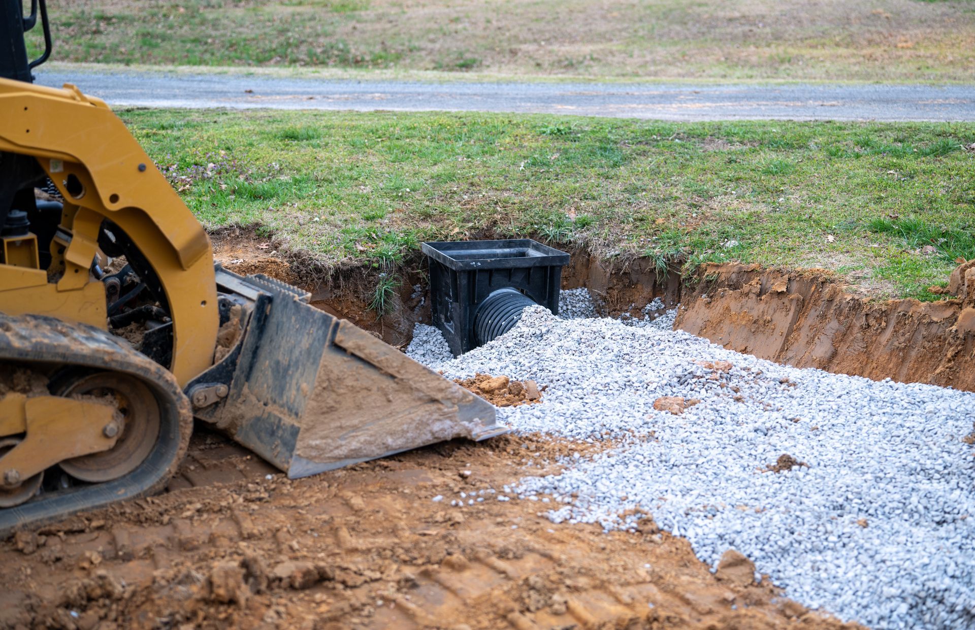
The grading work involves cutting high spots and filling low areas to establish a consistent slope across the affected surface, typically at a minimum grade that moves water without causing erosive velocity at the outlet. Around driveways, this includes reshaping the shoulders and adjacent ground so that runoff leaves the driving surface laterally rather than channeling along the edge or flowing across the width of the pavement or gravel. Where a low point cannot be effectively graded to drain by surface flow alone, a catch basin or culvert tied to a discharge route may need to be incorporated into the drainage plan before grading can be completed.
After drainage grading is complete, the low spots that previously held standing water will no longer collect runoff after rain, and the exposed soil around driveways and cleared areas will show less active erosion because water is leaving the surface before it can concentrate into channels. Ground that was previously soft and difficult to walk or drive across will firm up as drainage conditions improve, which is particularly noticeable in areas that had been repeatedly saturated. The corrected grade is visible as a consistent slope across the regraded surface—no visible low points or depressions collecting debris and moisture.
Drainage grading scope depends on the size of the affected area, the elevation differential available between the problem zone and the discharge point, and whether any underground drainage structures need to be incorporated. Properties that have been recently cleared or graded for construction are particularly prone to drainage issues because the natural surface contours and vegetation that previously managed runoff have been removed, leaving the ground flat or irregularly shaped without a consistent drainage path established.
Answers About How Drainage Grading Work Is Done
These questions address the drainage grading process itself—how grades are evaluated, what determines where water is directed, and what property owners should observe and report before an on-site evaluation takes place.
How is the existing surface grade evaluated before drainage grading begins?
Grade evaluation involves walking the affected area to identify high and low points, observing where water tracks and collects, and tracing the available drainage path from the problem area to the nearest outlet. In some cases, a simple level or laser grade reading is used to confirm the elevation relationship between the collection point and the intended discharge location.
What determines where runoff is directed after drainage grading?
The discharge location is determined by what is available at the property boundary—a roadside ditch, a natural swale, or a vegetated area with capacity to absorb or carry the volume of runoff involved. The grade is shaped to move water toward that outlet at a consistent slope that does not cause erosion at the point where flow exits the graded area.
Why does recently cleared land in Enoree often develop standing water problems that were not present before clearing?
Wooded land absorbs and slows runoff through root systems, ground litter, and the natural surface contours of undisturbed terrain. Once that vegetation is removed and the ground is disturbed by equipment, the surface is left without its previous drainage structure, and low spots that were previously managed by root uptake become collection points for surface water.
When is a culvert or catch basin needed rather than surface grading alone?
A culvert or catch basin is required when a low point cannot drain by gravity to a surface outlet—typically because the surrounding grade is too flat, the discharge point is too far away, or water volumes exceed what surface grading can redirect. These structures intercept the water below the surface and carry it to an outlet at lower elevation.
What visible signs indicate that drainage grading has been completed correctly?
After grading, the regraded surface should show no visible depressions or flat spots where water can collect, shoulders and adjacent ground should slope away from the driving surface or building perimeter, and the area at the intended discharge point should show concentrated but non-erosive flow rather than sheet flow spreading across unprepared ground.
Masengale Land Service also performs drainage grading in Simpsonville and the surrounding communities. To schedule an on-site evaluation, contact Masengale Land Service and describe the specific locations where water collects on your property so the assessment can be focused on the conditions that matter most to your project.